
An exploration of London’s most iconic lost rivers
Rivers are the lifeblood of London. The capital has more than 600 kilometres of rivers and streams flowing into London’s greatest river, the River Thames. London’s rivers can be beautiful spaces, but most of these rivers face pollution challenges and have been heavily modified, with some buried and hidden to accommodate a growing population of Londoners and their needs. Specialists say there are around 21 underground rivers in London, also known as ‘lost rivers’. Despite being hidden, these haven’t been forgotten, and their rich history is still very much alive through books, street names and memories.
Here, keep reading to learn more about five of the most iconic lost rivers in the capital.
River Effra
The River Effra is located in Lambeth, passing through West Norwood Cemetery, Brockwell Park and the Kennington Oval. Some believe the river got its name from the early medieval English word for ‘bank’ or the Celtic word for ‘torrent’, while others say it might be derived from the area of Hethra, or Manor of Heathrow, where the river used to flow through in Brixton.
With the development of Brixton and Dulwich into urban areas in the 1800s, streets and houses were built along the Effra, putting more pressure on the river’s flow. This led to severe flooding events in the area throughout the coming years.
Before being covered over between 1820 and 1860, the Effra had been used as an open sewer by the growing population in the area. By 1865, it had been connected into the sewage system created by the engineer Joseph Bazalgette, which is still in use today.
After being hidden, the Effra still resurfaced in the form of floods a few times. One of the worst events happened in 1914 when during a heavy storm the sewer overflowed, flooding houses and forcing residents to evacuate their homes for several days. In 1935 the sewer was enlarged to avoid more floods.
The Effra’s legacy can still be observed at the Kennington Oval cricket ground, which was partly shaped by a curve in the river and used soil excavated during the Effra’s enclosing on its construction.
Its most recent storm relief channel, where you can find a nameplate for the River Effra, is on the north side of Vauxhall Bridge, in front of the Security Service (MI6) building.
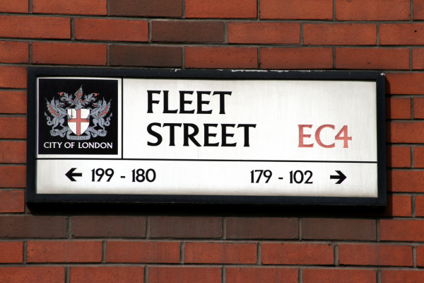
River Fleet
The most well-known of London’s lost rivers and the largest one, the River Fleet flows from Hampstead and Highgate through Kings Cross and all the way to Blackfriars Bridge. Its name is derived from the Anglo-Saxon word flēot, which means “estuary, bay or inlet”.
It was once a broad tidal basin that provided routes for trade and was a source of food, drinking water and bathing water. Holborn was named after Fleet’s higher reaches, which were known as the Holbourne or Oldbourne, from the word Holburna, meaning “hollow stream”.
The river became an open-air sewer since at least the 1200s, when industrial, human and animal waste was discarded into the river. By the 13th century, the lower section of the river was known as the Fleet Ditch. The surrounding areas became undesirable and cheap and were notorious for its poor-quality housing and prisons – most prisons of old London were built in the Fleet Valley.
Unsuccessful attempts to clean up the river were made in the 1500s and 1600s but pollution persisted. Part of the Fleet was firstly incorporated into Joseph Bazalgette’s sewage tunnels after the Great Stink of 1858, caused by waste disposal in the Thames. The Fleet nowadays is fully underground and largely part of the sewer system. However, if you pay enough attention, you can still hear it at Ray Street in Clerkenwell and at Charterhouse Street as it flows through the sewer.
River Tyburn
The River Tyburn originates in Hampstead, flowing through Regents Park and Buckingham Palace until joining the Thames in Pimlico. Its name comes from ‘teoburne’, meaning ‘boundary stream’ in early medieval English. The name of the area Marylebone evolved from the Tyburn village, named after the river, where there was a church dedicated to St. Mary. Over time, it became known as ‘St. Mary-on-the-Bourne’ and eventually transformed into Marylebone.
River Walbrook
The River Walbrook flows from Shoreditch through the City of London until it joins the Thames between Southwark and Cannon Street bridges. Its name is thought to have originated from the fact that it runs through the London Wall, built by the Romans as a defensive wall thousands of years ago.
The Walbrook used to run through the middle of the city, which was then known as Londinium, and had a key importance in transport and industrial development. The Romans considered rivers to be sacred. Temples and shrines were built along the Walbrook’s banks. In 1954, remains of the Temple of Mithras were accidentally discovered during construction work in the Walbrook area. Many artefacts are displayed at the Museum of London.
As the city grew, so did the pollution in the river. The Walbrook began to disappear in 1440 when sections of the river started to be buried. By 1600, it was fully underground.
River Westbourne
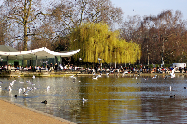
The Tyburn’s lower reaches were diverted into the King’s Scholars’ Pond Sewer by 1670, initially used for surface water drainage. The river was a source of drinking water and remained clean until the 1800s, different than the Effra and the Fleet mentioned above. It was used to create the Regent’s Park Boating Lake in the early 1800s. As the city developed, more sections of it were buried until the 1860s when it was turned into a waste sewer.
The River Westbourne springs from Hampstead Heath and flows through Hyde Park, Sloane Square and into the Thames near Chelsea Bridge. The origin of its name isn’t clear, and the river was also known as Kilburn and Bayswater in different sections, named after the areas it flowed through.
One of northwest London’s cleanest rivers, it was used as a source of drinking water. In the 16th century, a nearby spring with medicinal water was discovered, the Kilburn Wells, which was later turned into a spa. In the 1700s, the Westbourne was dammed for the creation of the Serpentine Lake in Hyde Park, and it also supplied the ornamental waters in Kensington Gardens.
In the 19th century, with the development of the north and western areas of London, the Westbourne became increasingly polluted. In 1827 the stretch of the river between Hyde Park and Sloane Square was culverted, the stretch that led to the Thames was also buried in 1854 and the remaining sections north of Hyde Park were forced underground in 1871.
The original pipe where the Westbourne flows to the Thames can be seen at Sloane Square Underground Station.
Although these aren’t visible anymore, their original routes can still be traced above ground.
While these modifications in the Effra, Fleet, Tyburn, Walbrook and Westbourne happened centuries ago, without the knowledge and the technology available nowadays, pollution issues continue to impact our rivers. Sewage, plastic pollution, agricultural and road run-off are some of the biggest threats. We must do better.
Join us in our mission to improve London’s rivers by volunteering with us or getting involved in citizen science initiatives.