Outfall safaris are tackling river pollution – and you can help as a citizen scientist!
Joe Pecorelli, the Zoological Society of London’s Europe Conservation Project Manager, tells us about work running across the capital to prioritise and map sources of pollution in our rivers, in which Thames21 has collaborated – and gives citizen scientist volunteers the chance to get involved.
Misconnections and cross connections, on which Thames21 has campaigned, between the foul sewer and surface water network are a serious environmental problem, responsible for degrading the ecology of rivers in the capital.
As I worked with members of the Catchment Partnerships in London (CPiL) group to create a position statement on the issue early last year, what became clear was that it is still a deeply ingrained, knotty problem despite a great deal of effort being put in by many people to resolve it over many years.
CPiL members have committed to help tackle the issue with, among other things, the generation of evidence to determine the scale and impact of polluting outfalls.
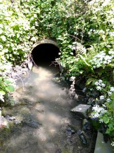
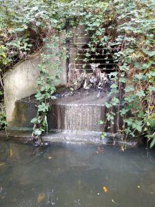
At the moment, reporting of problem outfalls is ad hoc from members of the public who happen to spot pollution entering our rivers.
Once notified, the Environment Agency and Thames Water put the offending outfalls on a list. Reported outfalls are resolved over a five-year investment period by Thames Water’s Surface Water Outfall Programme (SWOP) team.
Thanks to work by the Environment Agency (EA), the number being fixed each year has risen to the current rate of 40 per year.
But how do we know the current rate of fixes is a suitable response to the scale of the problem? What is the process by which outfalls can be prioritised? And who spots the outfalls that are polluting but tucked out of sight in stretches of river in private land or behind rows of houses?
The ‘Outfall Safari’ was created to provide answers to these questions.
Developed and first run by the Citizen Crane project in the Crane Valley catchment, which includes Environment Agency and Thames Water staff as advisers, it is a tool for running catchment wide audits of outfalls (‘outfall audit’….that’s why we jazzed it up a bit and called it a safari!).
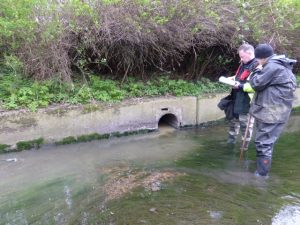
It uses Thames Water’s own method for assessing outfalls in a specially created app that can be used by volunteers – citizen scientists. The EA provided the scoring system which allows conversion of the assessment answers to an ‘impact score’ for each outfall. The impact score allows outfalls to be prioritised. Each safari is run over a one month period and is coordinated via a closed Facebook group, which volunteers join once trained.
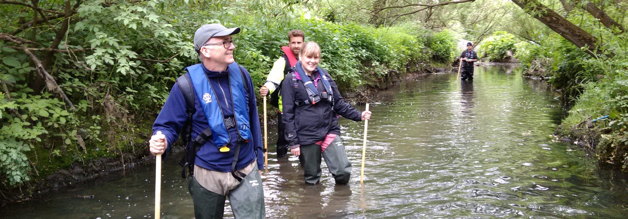
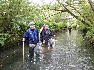
Because rain washes away evidence of pollution, surveys can only be conducted after 48 hours of no rain, so flexibility is needed by everyone involved. The trained volunteers only survey outfalls from the riverbank. They also identify areas of river that can’t be accessed so that ZSL and EA staff can follow up with in-channel surveys later. This way, together, we can survey whole catchments.
So far, surveys have been completed on the River Crane and Hogsmill and we are in the process of surveying the Dollis Brook. Data from the surveys is uploaded directly from a volunteer’s smart phone to a database and later mapped with GIS and shared with the EA and Thames Water. Outfalls that are seriously polluting are called in to the EA and Thames Water immediately from the river for follow up.
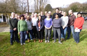
To date, an intrepid 66 volunteers have been trained by ZSL and more than 90km of river has been surveyed. The safari teams have recorded 518 outfalls, of which 23.4% showed signs of pollution and 3.5% of these were seriously polluting. Thames Water is using the data generated so far to inform their on-going SWOP work.
There are 394km of river that flow through Greater London. If we can scale up the use of the Outfall Safari and cover a good percentage of this total, we can start to gauge what would be a proper management response to the problem.
Maybe 40 outfalls per year is sufficient to get on top of the issue? One thing, though, is for sure: without the evidence we can’t even enter the debate and start the discussion with Thames Water about what a suitable sized SWOP programme should look like.
I’m very pleased to say, with thanks to recently confirmed funding from the Rivers Wetlands and Community Days, Outfall Safaris will be happening on the River Ravensbourne and River Pinn later this year – both in partnership with Thames21.
If you are interested in joining us, you’ll be contributing to an important pan-London study and might even enjoy a bit of sewage fungus spotting! Contact: joe.pecorelli@zsl.org, 07974 725557.
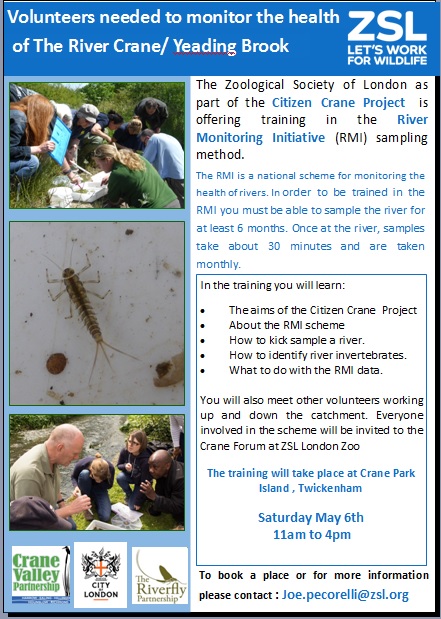
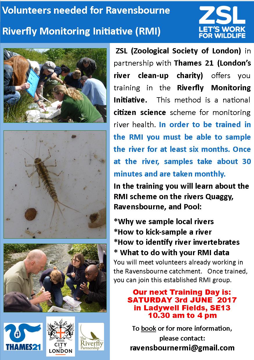
You can take your first steps towards contributing to Outfall Safaris, on two River Monitoring Initiative training days.
On May 6 RMI training takes place by ZSL as part of the Citizen Crane Project, at the Crane Park Island, Twickenham, from 11am to 4pm. To book, or for more information, contact joe.pecorelli@zsl.org
On June 3 Join Thames21 and ZSL for RMI training on the Ravensbourne in Ladywell Fields SE13, from 10.30am to 4pm. To book, or for more information, contact Ravensbournermi@gmail.com
Read more about how “misconnections” – plumbing connected to the wrong drain from a property – are damaging urban waterways and find out how you can check if your property is one of them.