Floodplains, explained
Rivers are extremely complex and important ecosystems. They provide countless services to people and have been at the centre of civilisations for millennia. River systems are comprised of many elements. However, not all of them are as well-known as sources, tributaries, and deltas, for example. Floodplains are one of those. Despite playing a special and unique role in agriculture and therefore, in food supplies, they are somehow taken for granted.
A floodplain designates a usually flat area surrounding a river or waterway, consisting of two parts: the floodway, which is the main river channel, and the flood fringe, which extends from the outer banks of the floodway to the edge of the valley, where the floor begins to rise.
It acts as a natural buffer absorbing floodwater during periods of high water flow and helps mitigate the risk of downstream flooding. In the UK, floodplains can be categorised into functional or inactive – the latter when they are disconnected from rivers by human intervention or natural processes and no longer function as flood storage areas.
These areas are formed by erosion, when soil is worn away by the water movement, and deposition when the floodwater deposits sediments on either side of the river. Erosion also contributes to creating meanders and changing the course of a river. When there’s a surge in water flow, the neighbouring areas are flooded, transporting sediment and organic matter. With time, the alternate processes of erosion and deposition create a rich floodplain able to absorb and hold excessive water during floods.
Due to floodplains’ fertile soil, many communities have settled and developed in and around those areas. Besides the nutrient-rich soil, the flat geography also contributes to farming and agricultural practices, as well as transportation. However, these come with an obvious flood risk, which is expected to increase in frequency and intensity over time due to climate change. As an example, the low-lying coastal floodplain area of southeast Queensland, in Australia, has been identified as a hotspot for climate change by the International Panel for Climate Change (IPCC).
They also provide a thriving environment for wetlands, marshes, and riparian forests which serve as homes and breeding grounds for a wide range of plants and animals such as birds, fishes, reptiles, and mammals. Floodplains are also crucial to water filtration, trapping sediments and pollutants and preventing them from reaching waterways and harming aquatic habitats.
Unfortunately, around 90% of England’s floodplains are inactive, leading to an increase in flood risk in nearby areas. The human-made modifications on floodplains drive excess water to flow faster downstream into urban areas as these no longer have be ability to store water. While urbanisation, intensive agriculture, poor river management and others have played their part in damaging and modifying floodplains, intensive farming is thought to have the biggest impact.
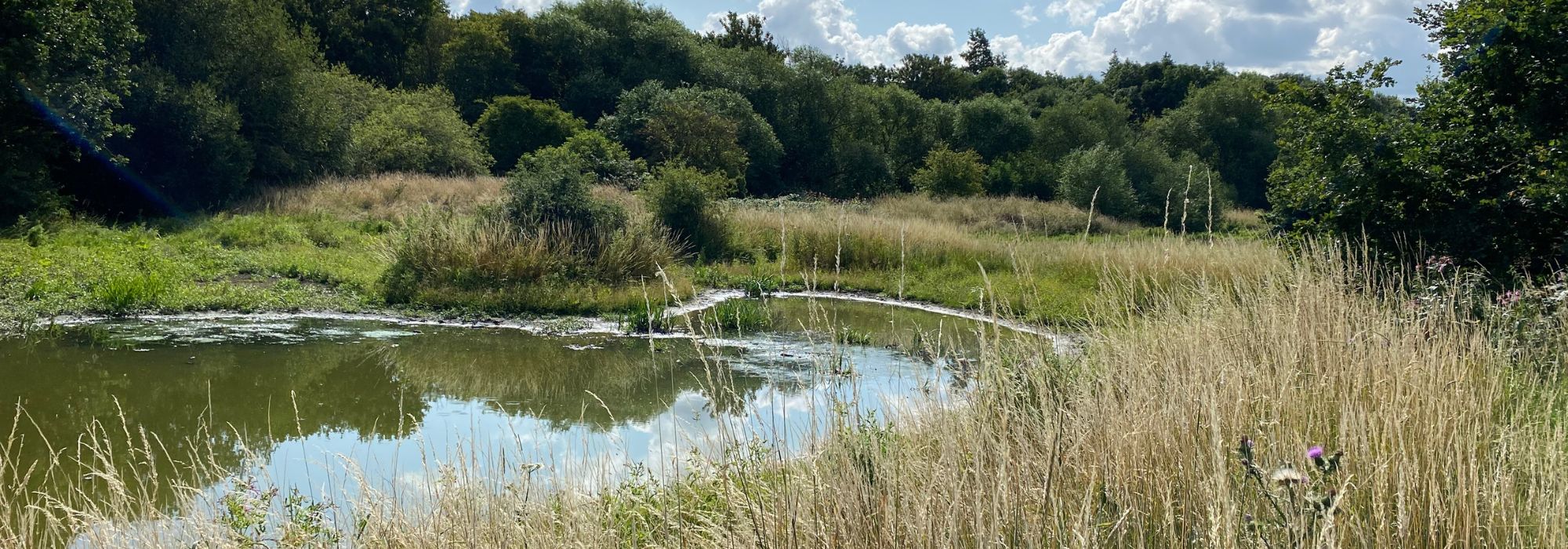
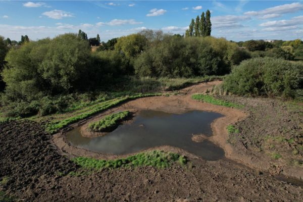
There are, however, nature-based solutions that can mitigate flood risks downstream and improve river health by reconnecting rivers to their floodplains. This is exactly what our Rewilding the Rom project is doing. The River Rom, a tributary of the River Thames that flows between the London Boroughs of Barking, Dagenham and Havering, has been disconnected from its floodplain. In 2021 two seasonal wetlands were built on the Havering Side of the river, acting as important flood storage, and habitats for plants, birds, and other animals. Last year, further work was carried out to construct more interconnected wetlands on the opposite bank, reconnecting the Rom with its floodplain.
Some other natural solutions to enhance disconnected floodplains are keeping and replanting natural vegetation, planting big trees near riverbanks that can fall into rivers and slow the water flow, and pollarding trees so they have more stable root structures preventing erosion in the riverbanks. Floodplain restoration strategies can slow the speed of the water flow between 10 and 15%, according to George Heritage, co-author of the study ‘The Changing Face of Floodplains’. However, multi-stakeholder action is necessary. Policymakers, farmers, businesses, and local communities need to come together to protect and enhance our rivers and build climate resilience.