Chandos Park
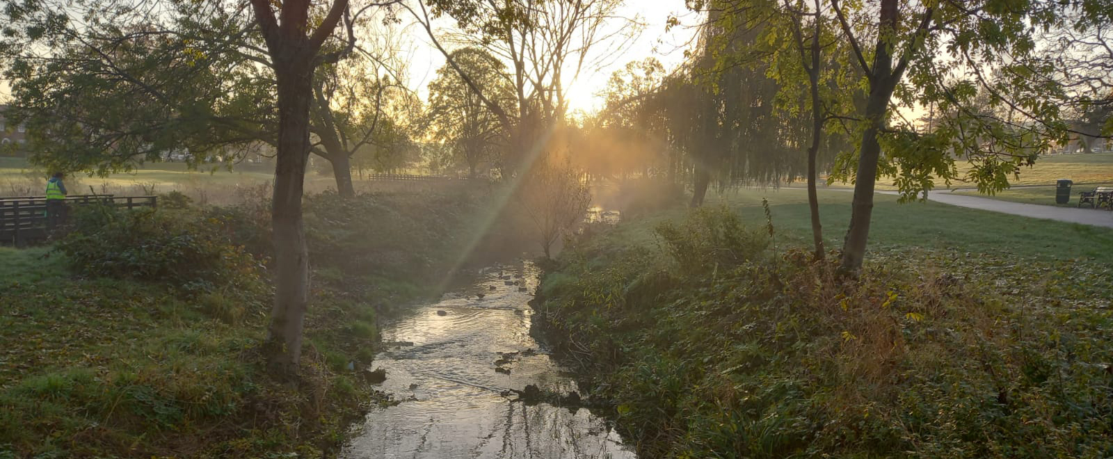
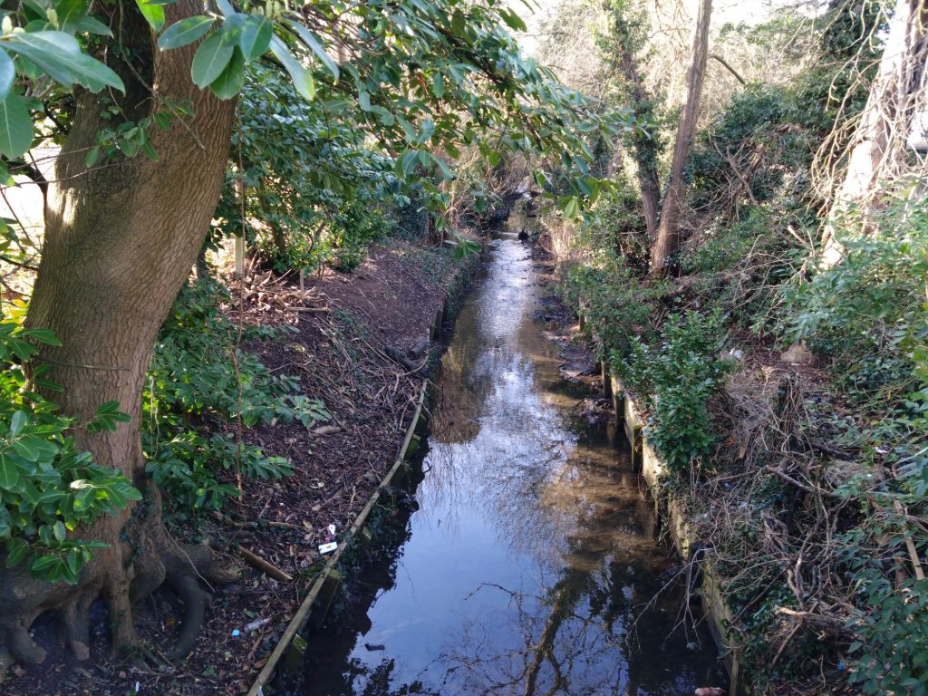
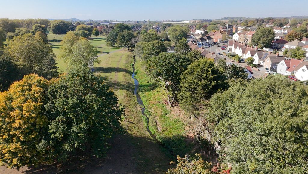
Before the project started, the Edgware Brook ran along the edge of the park behind a fence where it could not be seen. It has been re-aligned, bringing it further into the park and in-channel features have been added to enhance the ecological value of the river and allow it to become a more integral part of the park.
Where is Chandos Park?
Chandos Park is in the London Borough of Harrow just to the West of Edgware. It is also known as Chandos Recreation Ground. Click here for link to Google Maps.
Since the completion of the work in the park, Chandos Park has now won a Green Flag Award. Visit the park website for more information: Chandos Recreation Ground
We have also mapped out a sensory walk in collaboration with Sense. The walks are designed for people with complex disabilities, but can be enjoyed by anyone. Please click here to find the map for Chandos Park.
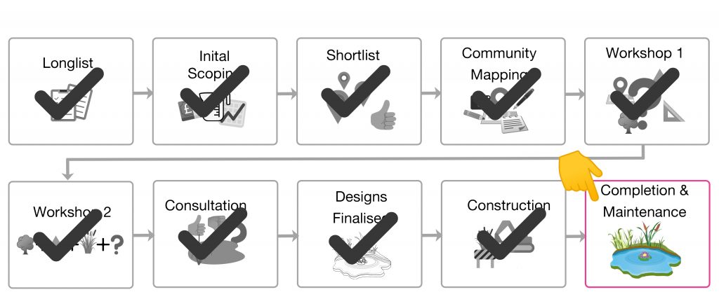
What phase is Chandos Park at?
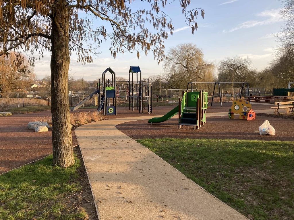
Completion and Maintenance: The construction phase is now complete in Chandos Park. Paths have been resurfaced, the new playground is installed and trees and shrubs have been planted across the site to increase biodiversity. New storage tanks for the cricket team and the Chandos Community Group are now in position.
You may have noticed that there is a slight difference in the (new) route of the water course from that shown in the original plans. This change has happened because an unmapped high voltage cable was found to be running underground in between the old footpath and the stream.
This has meant that we have been unable to move the stream as far into the park as we had originally intended. However, we hope that you will agree that despite this, the stream is most definitely now a feature of the park, rather than being hidden behind a fence. The 1 in 3 bank profile is more natural and provides opportunities for aquatic planting, much of the toe-boarding has been removed and the river is less straight than it was previously.
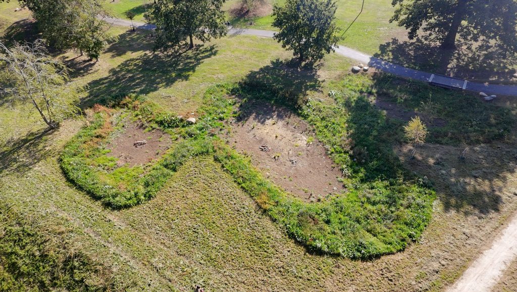
We have also been able to add two new wetland areas which will help alleviate flooding along the footpaths. The wetland area at the Western end of the Edgware Brook will be fed by overflow from the paths adjacent to Merlin Crescent. This area will likely be dry in the summer but will form pond like features in the winter where water will absorb naturally back into the ground. It will be a mix of amenity and wildflower seeded/grasses and will become part of the park landscape.
The wetland area at the Eastern end of the Brook will be fed directly by an underground pipe from the swales adjacent to the Methuen Road footpath and another pipe will take water from the wetland into the stream in periods of heavy rain.
See below for the detailed plans.
Keep an eye on our events page or sign-up to our mailing list to hear more.
Chandos Park Proposed Designs


These comments and questions were recorded at co-design workshops and community consultation days.
What aspects of the project are you excited about?
Viewing area by the brook
Improves the park and play area – long overdue!
Stream being part of the park
Will make the area look cleaner
Great to have stream in the park
Better family area, safe for kids, better outdoor space for all ages
| Questions, comments and concerns | Responses |
| When will the works start? | The works are planned to start at Chandos Park in Spring 2024. |
| How long will the works take? | We expect that the works will take between 6 and 9 months to complete. However, this is subject to contractor availability, weather and other unexpected situations out of our control that may arise and delay progress. |
| Will the park be closed during the works? | The park will not need to be fully closed for the whole of the project. Work will be phased and whilst work is taking place in one area, the other areas will remain open. We will do our best to ensure that disruption to use of the park is kept to a minimum. |
| How much is this costing and how is it being funded? | This project is funded by Defra as part of the £150 million Flood and Coastal Resilience Innovation Programme which is managed by the Environment Agency to develop and test new approaches to resilience tailored to local communities. Action for Silk Stream was awarded £6million and this will be spent across all of the project sites in Barnet and Harrow. In addition, Chandos Park has also received £300K funding from the GLA as part of the Green and Resilient Spaces fund and £200K match funding from Harrow Council. |
| Will there be lighting in the park? | There are no plans currently to (re)introduce lighting to the park along the paths. |
| Who is going to look after the park when the works have been completed to make sure it remains in a good state of repair? Is there a plan for the future? | Action for Silk Steam is collaborating with the River Trust for innovative financing that will focus on obtaining long term revenue funds for maintenance of the project after construction. This will ensure sustainability of the improvements to the river and land within those parks. A 10 year management plan will be produced as part of the project programme. The Council’s Parks/Green teams will ensure the upkeep and maintenance of the parks with the assistance of volunteers (i.e. stewardship/legacy). |
| Lack of bridge and access to the other side of the river. | A bridge could cause an obstruction during high flows – it would have to be very high and wide to avoid this which would make it difficult from an engineering and cost perspective. The land the other side of the river is designed as a limited access wildlife area and buffer zone between the park and the properties. Defensive planting of thorny species along the boundary will discourage access to the properties. Once the bank has been re-profiled so that it has a shallower slope it will extend almost all the way to the properties, so that the area of land the other side of the river will be relatively small. |
| Could we create a boardwalk that allows more of a connection to the river but doesn’t provide access to the other side? | The design team will explore opportunities for creating a dipping platform to facilitate access to the river for river dipping and provide a place to observe the river more closely. |
| Would the other side of the river be used by rough sleepers? | See above. The area of land will be small and have defensive planting which will discourage rough sleeping. The area will also be open and visible from the park with lines of site maintained, further discouraging rough sleeping. |
| What will the new path that runs along the re-aligned river be surfaced with? | There was a preference in the meeting that the new path would be sealed so that it is more erosion resistant and allows vehicle access to the electricity sub-station at the north-east corner of the park. |
| How deep will the water be? | This has not yet been modelled in detail but will be considered as part of the final design. As the channel will be widened the water depth will be shallower than it is currently. The banks will also be made less steep to provide safe routes out of the river in case of someone falling in. |
| What is the sequence of construction? Will the new channel be dug before the old one is filled in? | The site will be cordoned off and clearing will commence. The new channel will be excavated with material laid out alongside the existing channel. The old channel will be dammed and the new channel brought online. The existing channel will then be filled with existing material. The footpath will be constructed last to avoid machinery tracking over it and causing damage. |
Have your say
If you have any questions or suggestions, please email: Silkstream@thames21.org.uk
Be up to date
To be sure you stay up to date on all project plans, sign up to our mailing list here:
